Deforestation Alert Systems
Automated alerts when satellite imagery shows tree cover loss in a monitored area, often within days of it happening.
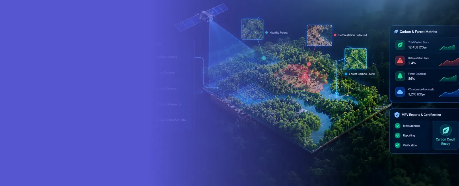
Comfygen builds digital MRV (measurement, reporting, and verification) platforms that track deforestation, estimate forest carbon stock, and generate the data a carbon credit project needs to get certified. Since 2019, our team has delivered 550+ projects for 400+ clients across 30+ countries.


Six ways Comfygen helps a forest project measure, report, and verify its carbon impact.
Automated alerts when satellite imagery shows tree cover loss in a monitored area, often within days of it happening.
Models that estimate above-ground biomass and carbon stock from satellite, LiDAR, or drone data, instead of manual field plots alone.
End-to-end measurement, reporting, and verification systems built to a carbon standard like Verra VCS or Gold Standard.
Data pipelines and reporting built around REDD+ methodology requirements for avoided deforestation projects.
Track canopy cover, species composition, and change over time across a managed forest or concession.
Dedicated developers who join your team for a single platform or an ongoing MRV build-out.
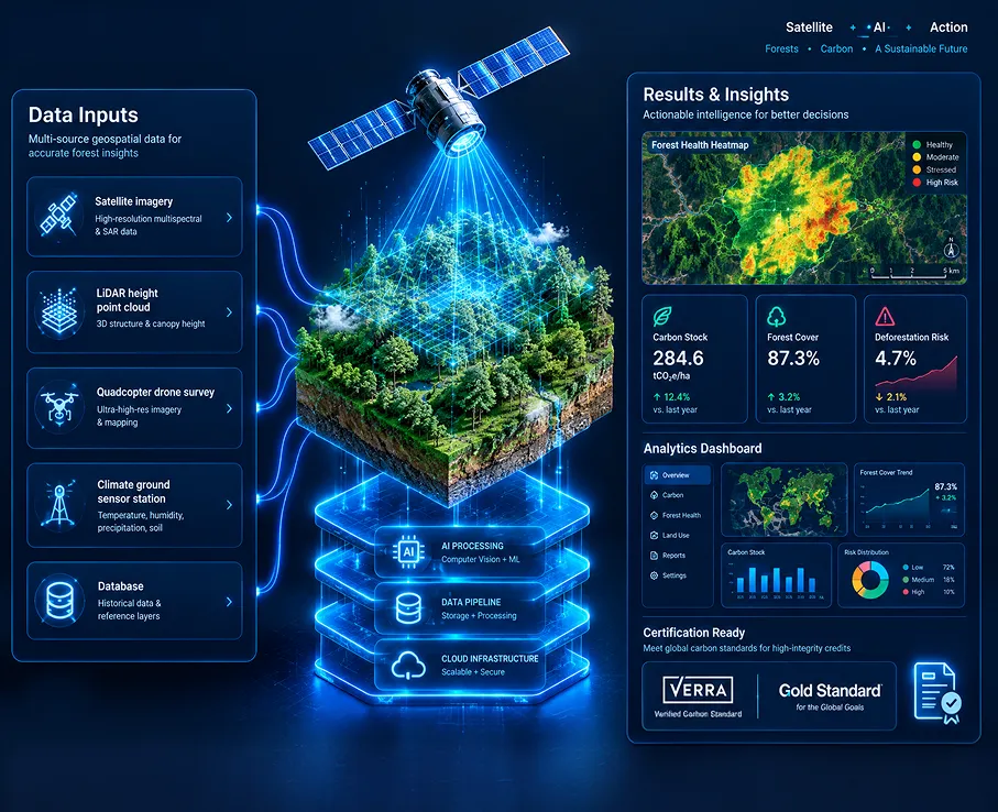
A forest carbon project earns credits by proving a forest is storing more carbon than it otherwise would, or that deforestation didn't happen where it might have. That proof used to mean field crews measuring tree trunks by hand and years of paperwork. A digital MRV platform replaces most of that: it reads satellite and LiDAR data, estimates biomass and carbon stock automatically, and produces a report built to a standard like Verra's VCS or Gold Standard.
Comfygen builds these platforms on the same satellite feeds and machine learning practice behind its wider geospatial AI development work, so a forest monitoring system can share data with a satellite imagery pipeline or feed straight into an EUDR compliance platform.
Comfygen does not have a public forest carbon MRV case study live yet, so here is what this page's claim actually rests on: the same engineering team already delivers AI and machine learning development and IoT development for clients in 30+ countries. Biomass estimation is a regression model like any other, and a reporting pipeline built to a carbon standard's template reuses the same data engineering practice the team already runs.
Ask for a small deforestation-alert demo on open Sentinel-2 imagery for a region of your choice, before signing off on the full build.
Ask for a proof of concept →🌲 Forestry & Conservation
🌍 Carbon Project Developers
🏛️ Government & Environmental Agencies
🌾 Agriculture & Agroforestry
🛡️ Insurance & Climate Risk
📊 Corporate ESG & Sustainability
Seven steps from first call to an accredited carbon MRV platform.
Map the carbon standard you're certifying against, the project boundary, and the reporting cadence it requires.
Satellite, LiDAR, and field data sources get mapped into a pipeline aligned with the standard's requirements.
Biomass and carbon stock estimation models get trained and validated against ground-truth plots from your project area.
The platform's outputs get tested against the standard's reporting template and a sample verification run.
The system goes live with monitoring in place, and Comfygen's team stays on through each reporting cycle.
Model accuracy gets checked against new field data each reporting cycle, and recalibrated as needed.
New project areas or a path into EUDR compliance get added on as the platform grows.
 Sentinel Hub
 Planet API
 Google Earth Engine
 PDAL
 lidR
 NASA GEDI
 PyTorch
 TensorFlow
 scikit-learn
 PostGIS
 GeoServer
 AWS Cloud
 Google Cloud
 Azure
 Verra VCS
Carbon MRV platforms need careful data engineering, which Comfygen's team has been delivering since 2019.

550+ projects delivered to 400+ clients in 30+ countries since 2019, with a 97% client retention rate standing behind it.
Reporting output is shaped around Verra VCS or Gold Standard templates from the start, not bolted on just before verification.
Biomass models get validated against ground truth from your own project area, because a generic global model won't pass verification.
Ask for a deforestation alert demo on open Sentinel-2 imagery over a region you choose, before the full build starts.
Comfygen stays on to check model accuracy against new field data and recalibrate it as each reporting cycle comes around.
ISO 9001, ISO 27001, and ISO/IEC 20000-1 certification cover the work, which runs from Comfygen's Jaipur, Toronto, and Euskirchen offices.
Add dedicated geospatial and ML engineers to your team without the recruiting cycle.
Flexible engagement: hourly, part-time, or full-time
Direct access to your assigned developers
No recruitment or HR overhead
Start within days, not months

A digital MRV platform automates measurement, reporting, and verification for a forest carbon project. It reads satellite, LiDAR, or drone data, estimates biomass and carbon stock, and produces reports formatted for a carbon standard like Verra's VCS or Gold Standard.
Satellite-based biomass estimates typically land within 10 to 20 percent of field-measured values, and accuracy improves when the model is calibrated against local ground-truth plots rather than used as a generic global model.
Comfygen builds reporting and data pipelines aligned to Verra's Verified Carbon Standard (VCS) and Gold Standard, the two most widely used voluntary carbon market standards.
No, and most carbon standards don't allow it to. Field plots are still required to calibrate and validate the satellite-based model, but a digital MRV platform cuts how many plots are needed and how often field crews need to visit.
A focused dMRV platform typically takes 14 to 22 weeks, depending on how many data sources it integrates and which carbon standard's reporting format it needs to match.
Forest monitoring and carbon MRV tracks and reports on a forest's carbon stock, usually for a project that earns carbon credits. EUDR compliance software checks whether a specific commodity's origin is deforestation-free, a narrower regulatory requirement rather than a credit-generating project.
Yes. A smaller deployment can cover a single concession or conservation area, useful for compliance reporting or grant requirements even without a full carbon credit project behind it.
Yes. The same deforestation alert system used for carbon projects can flag unauthorized tree cover loss in near real time, useful for enforcement as well as carbon accounting.
Hear what our clients have to say about their experience working with us
📹 Video URL: https://www.youtube.com/watch?v=kedGnt6T-DI
🖼️ Thumbnail URL: https://www.comfygen.com/comfygen-images/comfygen/nitesh-rajput-testimonial.webp
Book My Tutor
📹 Video URL: https://www.youtube.com/watch?v=-AkHiORQTjA
🖼️ Thumbnail URL: https://www.comfygen.com/comfygen-images/comfygen/sayead-shadab-arif-testimonial.webp
Froge Flex
Tell Comfygen's team which carbon standard you're certifying against and how large the project area is. A short discovery call is enough to scope the first version.


Abhishek Singh is a Project Manager at Comfygen Technologies, leading mobile app solutions for clients across 7 countries. He has managed 20+ end-to-end builds across delivery, healthcare, finance, education, and ecommerce platforms. His Python background gives him a solid technical grip on what he's managing, and he handles scoping, planning, and delivery to keep every project on track.
We have the knowledge and skills to work on diverse niches with high-performing solutions. Get insights about the tech revolutions and their significance through our updated blogs.